
#28 Moriah
5/16/10
I forgot my boots! Really who does that? You’re going to New Hampshire to hike and you forget your boots. You know there is going to be snow so your Gore-Tex boots are important. Urg. I was not pleased when I opened the trunk and realized this. Luckily I was wearing my North Face trail sneakers. They would have to be my footwear.
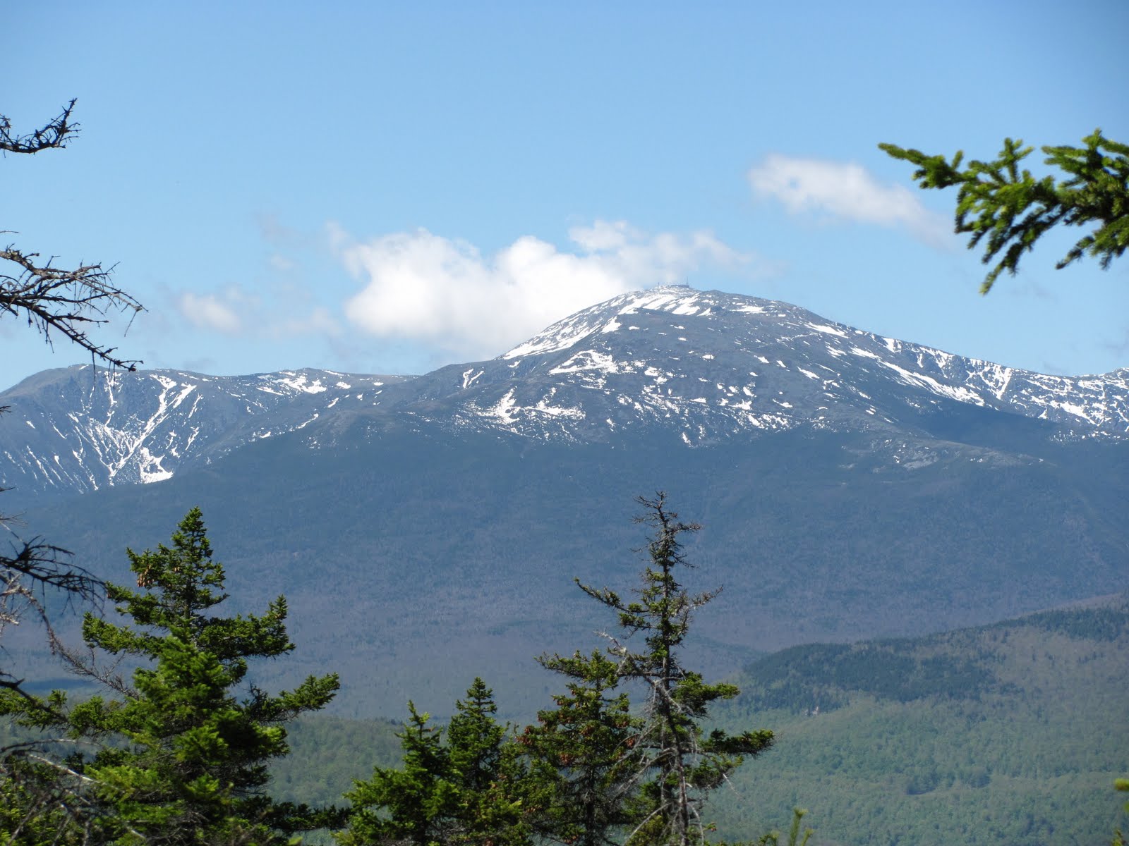
So the Carter-Moriah trailhead was at the end of a neighborhood. It was kind of strange. No parking lot. We were able to park right there though. Turns out we were the only ones on the trail that day. Off we went. Uphill right away. Lucky for me the trail was dry to start off with. I knew this wouldn’t last though. The beginning of the trail was not that interesting. Some uphill, some flats. After a little while we reached the first of a bunch of rock slabs to walk up. I can imagine these would be difficult if wet or icy. Some of them even opened up for some nice views toward the presidentials. Then the snow started. We were at about 2800ft. At first it wasn’t a problem, there wasn’t that much of it. With the snow came some mud though. I was trying to avoid some mud and stepped on some snow. Soft snow. Down my foot went, into the muddy water. I could feel the wetness through my socks. So it begins. Soon enough there was no avoiding snow. It covered everything. Since it was warm out the snow was also soft in spots. That meant post holing. I’m not really sure my gaiters really made a difference. I could tell my feet were wet but at least they weren’t cold. Then the kicker. We got off trail again. Two hikes in a row. There was a ton of blow downs, which made it difficult to follow the trail. I have to admit I was frustrated. Last thing I wanted with wet feet was having the hike take longer. Good thing for dad’s GPS. We were able to figure out where approximately the trail should be and went that way. Eventually we did find the trail again. It wasn’t too long after that before we made it to the top.
It was rather windy and chilly at the top. That didn’t stop me from sitting there and eating some lunch. There is a nice large rock at the summit, which was free of snow. Another groups of three hikers from Montreal came up right after us and we all had plenty of room to sit on the rock and enjoy the 360degree view.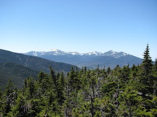 Now my feet were getting cold.
  When I was moving they were good but once I stopped and the wind was getting to them it wasn’t as good. We took a little break and then headed down. Back in the snow. Dad put on Yak-Trax but I decided to just slip and slide my way down. Following the trail was a little easier this way. We did have to refer to the GPS twice but we made it. I was going at a rather fast pace. I was ready to be done with this hike. I probably would have felt different had I had dry feet, but that is my own fault. Going back down was fine, I slipped a few times but otherwise uneventful.
5/16/10
I forgot my boots! Really who does that? You’re going to New Hampshire to hike and you forget your boots. You know there is going to be snow so your Gore-Tex boots are important. Urg. I was not pleased when I opened the trunk and realized this. Luckily I was wearing my North Face trail sneakers. They would have to be my footwear.
So the Carter-Moriah trailhead was at the end of a neighborhood. It was kind of strange. No parking lot. We were able to park right there though. Turns out we were the only ones on the trail that day. Off we went. Uphill right away. Lucky for me the trail was dry to start off with. I knew this wouldn’t last though. The beginning of the trail was not that interesting. Some uphill, some flats. After a little while we reached the first of a bunch of rock slabs to walk up. I can imagine these would be difficult if wet or icy. Some of them even opened up for some nice views toward the presidentials.
 Then the snow started. We were at about 2800ft. At first it wasn’t a problem, there wasn’t that much of it. With the snow came some mud though. I was trying to avoid some mud and stepped on some snow. Soft snow. Down my foot went, into the muddy water. I could feel the wetness through my socks. So it begins. Soon enough there was no avoiding snow. It covered everything. Since it was warm out the snow was also soft in spots. That meant post holing. I’m not really sure my gaiters really made a difference. I could tell my feet were wet but at least they weren’t cold. Then the kicker. We got off trail again. Two hikes in a row. There was a ton of blow downs, which made it difficult to follow the trail. I have to admit I was frustrated. Last thing I wanted with wet feet was having the hike take longer. Good thing for dad’s GPS. We were able to figure out where approximately the trail should be and went that way. Eventually we did find the trail again. It wasn’t too long after that before we made it to the top.
It was rather windy and chilly at the top. That didn’t stop me from sitting there and eating some lunch. There is a nice large rock at the summit, which was free of snow. Another groups of three hikers from Montreal came up right after us and we all had plenty of room to sit on the rock and enjoy the 360degree view.
 Now my feet were getting cold.
  When I was moving they were good but once I stopped and the wind was getting to them it wasn’t as good. We took a little break and then headed down. Back in the snow. Dad put on Yak-Trax but I decided to just slip and slide my way down. Following the trail was a little easier this way. We did have to refer to the GPS twice but we made it. I was going at a rather fast pace. I was ready to be done with this hike. I probably would have felt different had I had dry feet, but that is my own fault. Going back down was fine, I slipped a few times but otherwise uneventful.


