Saturday, May 30, 2009

Mt. Jackson

Backtracking #10: Mt. Jackson, NH
December 13, 2008

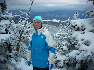
The physically hardest day of my life thus far. Two days earlier a major ice storm struck causing major damage around Mass. and NH. The White Mountains didn’t have it as bad as the southern part of the state but there was still ice around. The forecast for Waterville was a high of 10 and for Mt. Washington –10. I figured Mt. Jackson would be in the middle of that. Needless to say no one else came up to Waterville this weekend with us.

Due to it being one of the shortest days of the year we headed out early (well early for us). I think the car thermometer said 8 degrees, the warmest part of my day. As we headed out the temp went down. There were clear blue skies until we got to Franconia Notch. There were clouds in the notch and it was like going through a storm. Oh yeah the thermo read –3 at this point. We got through to blue skies and slightly warmer temps. I was excited because I thought we would have fantastic views of Mt. Washington and the rest of the Presidentials with these skies. My hopes were dashed when we spotted Crawford Notch. It was just like Franconia, road to top of mountain clouds, only in the far southern presidentials. It was like a sick joke, not only is it going to be very cold but also you won’t get to see anything. First, we tried to park in the train depot again, no luck, not plowed. Then we tried Mt. Clinton road, no luck, ice skating in a car. So we went to the Highland Center and got permission to park even though we weren’t staying there.

We headed out with lots of layers on. It didn’t take too long before I needed to delayer. This time I was smarter and delayered sooner. The trail was a little icy but we decided to bare boot. We worked our way up the Webster-Jackson trail at a slow pace. When the trail split we went toward Mt. Jackson. We had wanted to do Jackson and Pierce today so we wanted to get right to goal #1. About halfway up I saw dad’s thermometer read 0 degrees, lovely. It was taking forever, I couldn’t figure out why, this was supposed to be one of the easier 4kers. It was interesting seeing the trees encased in a thin layer of ice. Maybe that should have been a hint to me that this was more difficult. We took our crampons and thinking back they might have been helpful. Now I have Yak-Trax, those would have been good too. It was a bit slippery and very cold. Minor details. Finally, there was a little opening in the trees and the clouds and we could see the summit. This was about the time that my face started to hurt because it was so cold. I put my goggles back on to help a little. There was a little steep section that took a little work but we got through and soon we were about to go above tree line. As we got closer to the top you could feel and hear the wind. Looking at dad’s thermometer reading –5 now I knew I was about to need ALL layers, including my Under Armor Facemask Hood. If it was –5 without the wind I didn’t want to know what it really felt like on my skin with the wind. I almost lost my balance at one point due to the wind. There was another man up there and he was crouched down next to a cairn for protection. It wasn’t giving him much. We asked if he knew which way to Mt Pierce and he pointed us in a direction. We went that way a little bit, found some better shelter and stopped for some hot chocolate.

I didn’t think the sent us in the right direction but at this point we weren’t going back after going down a steep snowy section. The clouds parted for about 30seconds and we saw Mt. Washington perfectly, beautifully. Neither of us had our cameras ready but we got to see it. This also reaffirmed my suspicions we were sent the wrong way. Oh well, the wrong way meant going toward Webster Cliffs and the way down. It didn’t take long for dad to also start to realize this was the “wrong” way. I think both of us were starting to be very tired and were ok with the “wrong” way. There didn’t appear to be any ice between Jackson and Webster so we had to strap on the snowshoes. I had my new MSR Denali’s but dad still was using his old, way too long, recreational Columbia’s. He kept losing a shoe and was getting very frustrated. At one point I felt almost hopeless. We had a long way to go, I was spent, and afraid we wouldn’t make it out before dark. I had my headlamp but I knew dark meant even colder temperatures. We started heading downward which made me happy. The trail wasn’t too bad until right before Silver Cascade. I think if you saw me I would have looked like Tom when Jerry got away. Angry, confused, eyes super wide open. I couldn’t believe I had to go down that steep hill and then back up on the other side. At least the cascade looked cool frozen over. Somehow we scrambled up and I realized we were at the Jackson Webster split. We were going to make it out before dark. I think we both got a little hop in our step because we knew the trail wasn’t bad from here down. We quickened the pace and made it out to the road as it was getting dark. Dad got back to the car sooner then me, I couldn’t move any quicker. We decided to go into the Highland Center to warm up some before heading back to Waterville. On the way home we stopped and took some pictures of Mt. Washington looking magnificent, with no clouds, at all.


Thoughts: I never knew how much the cold weather could take out of you. I had good layers and only felt cold right when I stopped before I could layer up and right at the top when I was exposed and standing to take pictures. So even though I didn’t feel cold, it was cold. My Camelbak tub froze last time so this time I put hot tap water in and blew the water out each time. This lasted longer then I thought. I also put hot tape water in a Nalgene, which then was in an insulated pouch. By the end it was icing but lasted the whole day. In the end I was happy we were sent the “wrong” way. It would have been a huge struggle if we had gone our intended route. So thank you to the man who sent us the wrong way. I ended up falling asleep at 7PM that night and slept a long time.

Mt Field and Tom

Backtracking #8 and 9: Mt Field and Tom, NH
November 29, 2008

Our Waterville weekend dad was working an outage at work so I went up with Katie and Heather again. Heather’s ankle was still not 100% so we took to the trails in the valley below 3000ft. There are a ton so we weren’t bored. Only thing was that meant for 2 months we weren’t hiking a 4ker. I was in withdrawal. Dad hates outages, and had to work on Thanksgiving so when I suggested we go hike when he was done. He liked the idea. Online he found a cheap hotel just north of North Conway. I was about to get the best of both worlds, shopping the N. Conway outlets on Black Friday and doing 2 4kers.

We parked at the train depot right next to the Highland Center. A few cars were there already and the snow was packed down so parking wasn’t a problem. We crossed the railroad tracks and hit the trail. I was very excited because these would be my first 4kers in the snow. Unfortunately, we had left our snowshoes and my boots in our condo closet. Luckily, I found a pair of North Face winter boots on sale the night before at EMS. As for the snowshoes we were going to have to suck it up. At first this wasn’t a problem because the Avalon trail only had 3 or so inches of snow. Once we got to the junction with the A-Z trail the snow was getting deeper. We headed toward Mt. Avalon. Although not a 4ker I heard there are great views so we decided to take the spur to the top. There was one section that was somewhat difficult without the snowshoes because it was steep with deep snow. We did eventually get up and got to enjoy the view while snacking. This was also our first experience with the gray jays. Wow, they are friendly. After a short stay we headed north toward Mt. Field. The summit was not above tree line but there were some open views. It was a lot colder then I expected too. I was trying to get food out of my bag without my gloves on and it didn’t take long before they hurt from the cold. We had some more snacks and some hot chocolate but quickly headed down due to the cold and dwindling day light.

We headed along the Willey Ridge Trail toward Mt Tom. Now this is where the snowshoes would have been handy. We did plenty of post holing in well over a foot of snow. Although this part of the trail was easy it was taking a while because of the conditions. We finally got to the spur to Mt Tom and dad said we didn’t have time. We were going to run out of daylight. I tried to protest some but it didn’t work so we headed down the A-Z Trail. After a few yards dad changed his mind. If we went quickly we can do it. So we turned around and headed up the Spur Trail. I was very tired when we finally found the top. Clouds were rolling in so it wasn’t as nice of a view as it could have been. On our way back though we had a parting of the clouds and out popped Mt. Washington. What a view. No time to sit around and admire, we need to get out of here before it gets dark. Off we went at a rapid pace down to the car. The sun had gone down below the mountains when we got back but there was some light still so it wasn’t bad. I was drenched in sweat though. I couldn’t wait to change clothes.

Thoughts: I think I am going to really enjoy this winter hiking. Notes to self: Don’t leave the snowshoes in the condo closet. Learn to layer better and stop and delayer if you are getting real hot. Bring 3 pairs of gloves because your hands sweat a lot.

Friday, May 29, 2009

Mt. Monadnock, NH

Backtracking: Mt. Monadnock, NH
Early Oct. ‘08

My niece’s 1st birthday was our Waterville weekend so I knew I wasn’t going to get a 4ker in. By this point I am becoming obsessed and needed to get a good hike in. I suggested Mt. Monadnock. Now you have to realize we live a solid 2.5 hours away from it along Long Island Sound in CT. On top of that I was meeting a friend at 3:30 to go out to dinner. Minor details. We set off early and made our way north. As we pulled in a ranger was meeting the cars to check if people were really prepared to hike. We were set so we parked and headed out.

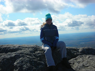
I had read that the most popular trails were the white ones so we decided to go Cascade Link to Red Spot. This was a good choice. Not crowded and some fun climbing. Even some scrambling. When we got up near tree line there were some huge boulders with views. I swear I could see Boston from there. It was clear for miles and miles. As we got above tree line things got very windy and a bit chilly. I had packed layers so on went the wool hat, gloves, fleece, and vest. The summit was rather crowded with people mostly coming up the white trails. It was way too windy to really enjoy it though. Although I would have preferred less wind it was still awesome 360 views of the area. It was kind of weird being on this bald mountain that was only just over 3000feet with nothing close to as big nearby.


We found some protection from the wind, had some snacks and headed down. We were on a tight time schedule so we went down at a swift pace. We decided to go down the White Cross Trail and passed a whole ton of people coming up. We made our way down rapidly with no problems. Right at the beginning there were some steep sections but they were dry and didn’t cause any problems. We made it back to the car and home a little after 3:00.


Thoughts: Great sub 4ker. Fabulous 360 views from the top. I recommend going up Red Spot to avoid the masses going the two white trails. Going down them wasn’t bad.

Thursday, May 28, 2009

Mt Moosilauke

Backtracking #7: Mt Moosilauke, NH
September 20, 2008

So a few days after doing Mt. Washington I had my first, first day of school. I am a first year teacher so that was a little scary for me. Hey, if I can do Mt. Washington I can handle a room full of 10 year olds. Now I am writing this 15 school days until our last day. Dad decided Mt Moosilauke looked like a good one. This time we finally convinced others to go along with us too. Yay for Katie and Heather.

We headed out from WV and made our way toward the mountain. We got stuck behind a slow moving red truck and it seemed like it took forever to get to the dirt road to the Moosilauke Lodge. Soon enough we were there and unloading the car. Unfortunately dad left the spout on his Camelbak in the open position and red Gatorade/water mix was all over the trunk and his bag. Luckily the Lodge was open so he could go in and fill up with water. Once he was set we were on our way up Gorge Brook trail. This seemed like a piece of cake compared to a month before. We went at a nice easy pace and for the first time I was almost comfortable hiking. One of my favorite new things has got to be getting above tree line. It is like a whole other world. Since Katie is a geologist I used this opportunity to have her teach me a thing or two about rocks since in a few months time I had to teach them to my students. I was not a very good student, I was struggling to name the rocks around me. Oh well. That kept me entertained for a little while as we got closer to the summit. The summit was more crowded then I expected since the trail wasn’t very crowded. We found a comfortable place to sit and had some lunch. We stayed a little longer then normal to enjoy the beautiful day.

Dad likes loops so we took the Snapper Trail to the Carriage Road. Now this is a fairly easy trail, not too steep or rocky. Well maybe that was the problem. It was too easy and we weren’t paying as good of attention as we should. Heather fell and sprained her ankle. Ouch. She took it like a champ though. I offered up my poles, which she gladly accepted, and we took turns carrying her bag. Now we still had almost 3 miles to go to get back to the car. It took a while, but she made it and we only had to help her a few times. Before the way down on the hike I was thinking about getting hiking shoes to use on dry warm days instead of using boots. Those thoughts are long gone. I saw how an easy trail could lead to an injury. This also made me realize how injuries on a mountain are different then on flat land. If it was much worse how would we have gotten her down? I was also very happy that I had purchased the poles a few weeks ago.

Thoughts: All in all I enjoyed the hike. It was a decent hike but I didn’t feel like I was torturing myself. Maybe it was an easier trail or maybe I was starting to develop those slow twitch muscle fibers. Either way it was a good day for me.

Wednesday, May 27, 2009

Mount Washington

Backtracking #6: Mount Washington
August 23, 2008

This hike (especially the way up) is a bit of a blur. I tend to daydream and sing to myself to block out what I really am doing. It helps me push through when my body wants to stop.

As usual we headed out from Waterville Valley and made our way to Pinkham Notch. Holy crowded! We had to park out on the road. We headed up the Tuckerman Ravine Trail with everyone else. Everyone said to bring layers; it’s cold up there. So I started with pants and a t-shirt, long sleeve layers in my Camelbak. It didn’t take long before I was hot and had to zip the legs off. I don’t remember too much about the walk toward Tux. Dad had read somewhere that Lion’s Head was less crowded so we headed that way. Sure enough there were a lot less people that way. By the time we hit tree line I was sweating and wondering when the cold would kick in. We took a break and talked on the phone to mom. After our short break we kept going up until we leveled off. Thank goodness. We took another break surround by a whole bunch of other people and then headed out a long the rim of Tux. The view was amazing. Soon enough we had to head up those big, lovely rocks, that those who hike up Mt. Washington know and love. My adrenaline kicked in at this point, dad on the other hand didn’t appear to have this same kick. The mass of humanity looked like a slow moving train both up and down. At one point I saw someone fall and literally tumble down a few rocks. The man popped right up, said he was ok, and continued on. I couldn’t believe what I was seeing. No stopping now. I wanted the top. Oh yeah, the cold weather, well I was still waiting on it. I got to the parking lot before dad thus giving myself a chance to rest. Once he joined we headed up to the real top.

Now I really wanted a picture with the summit sign. Unfortunately all those people who drove or cogged up were in line to get pictures. I was way too tired to wait in line. We headed in to get food and Gatorade. I have to say I did really enjoy having real food (chili dog!). I went downstairs to the Observatory Store and dad followed. The “This Body Climbed Mt. Washington” t-shirts were calling our names. I also got a hoody. I had to carabineer the bag to my Camelbak because it couldn’t fit in. We refreshed our water and headed out to the deck for more pictures. Finally I put on a long sleeve dri-fit shirt. Turns out it was 70degrees at the summit. A record high for that day and near the overall record. There was some wind, hence the reason for long sleeves. After a little while we headed down. I was intimidated looking at Tux the way down. It was hard for me to imagine we were going to hike down that, it seems so steep. I was a little scared because the trail was steep and wet at times. About half way down dad slipped and fell. Luckily he fell on one of the larger rocks so he didn’t keep going down, just some scrapes and a little blood. I was much more comfortable when we got into the bottom of the bowl. From here on out the hike seemed easy. This is a good thing because with about a mile left my legs were rubber. I was going on autopilot. We were very happy to not only see the car but also see there was no ticket since we were parked in the road.


Final thoughts: DO IT! You will feel so accomplished. I recommend doing some smaller ones first. Some friends who have done it and didn’t do other hikes were hurting big time afterward. I was sore but it wasn’t too bad. Now I really want to take on the rock pile in the winter.

Monday, May 25, 2009

Mts. Lincoln and Lafayette

Backtracking 4 and 5: Lincoln and Lafayette Franconia Notch, NH
July 26, 2008

After researching some we didn’t feel ready to do the Tripyramids yet so we needed to branch outside of the Valley. We still wanted something not far away so our sights were set on the Franconia Notch area. While there were some easier hikes there we decided to dive right in and hit up some 5000fts. Hey, the view from Franconia Ridge was suppose to be fantastic, we like views.

We headed out from Waterville and were to the trailhead by 9am. Our plan was to go counterclockwise up Falling Waters to Little Haystack, along Franconia Ridge, and then down to the Greenleaf Hut and Old Bridle Path. The beginning of Falling Waters was very pleasant and we commented that mom might enjoy it with some nice waterfalls. Soon enough we got to a big waterfall and started heading up. This is where things started getting crowded too. At one point, as we were walking right along the stream, a girl in front of me slipped and fell back landing on my feet. She was ok, but her group let us go past. I have to admit this trail gave me a serious butt whipping. I was riding my bike between hikes but not doing much else to work on those slow twitch, endurance muscles. I struggled mightily, so I truthfully don’t remember much of the way up besides the waterfalls, a few water crossings that weren’t difficult, and a whole slew of French-Canadians. Being a former DI athlete I had put my body through a lot in college so I didn’t (refused to maybe is a better way to put it) give up. I needed some frequent, short stops but powered through. Finally we hit tree line. The excitement and adrenaline made me forget the pain I was in and I quickly got to the top of Little Haystack. Wow, what a view! There were some high level, fair weather clouds but otherwise it was fantastic. The 360 views were terrific. It was a bit intimidating seeing where we still had to go though. We took a break, had some snacks, and headed out.


The Franconia Ridge walk was awesome. We got stuck behind a group on the way to Lincoln but that was ok because they were going at a comfortable pace. I felt very accomplished to reach the top of Lincoln, my first 5ker. Again we took some pictures but then carried on to the real destination, Lafayette. Now for some reason I thought Lafayette was a mile high so I was a bit disappointed when I found out he is only 5260, 20 feet short. Right before the summit it got a little steep but again I have this adrenaline when I am up top and got up much quicker than dad. Maybe when I am standing on that old foundation, if I jump up with my hands up, my hands can touch a mile high. Eh, not so much, no mile high for me today. The top was crowded which didn’t bother me, but it was buggy!?!? What in the world, the Ridge wasn’t, nor were Lincoln and Haystack. Way to ruin it for me. We didn’t stay too long because of the bugs. Got our pictures and headed down.

We stopped in and visited Greenleaf Hut. Thank goodness it was there because we both had run out of water. It was a hot day, we were exposed for a good 2miles and didn’t have anything besides a 70oz Camelbak. We bought some lemonade and ate more snacks. I also bought a patch from the hut. We then headed down Old Bridle Path. This was much less crowded. There was a couple from the Boston area that we were following for a while but otherwise not many other people. There were a few steep sections but nothing too bad, even a few views looking back to the Ridge. Along the way there was a AMC trail maintenance crew working and moving some big rocks, impressive. We got back out to the trailhead but still had to go under the highway to get to Lafayette Place where we parked. I was exhausted. Spent. Tired. But wow, amazed with the awesome views, and proud of myself for doing two 5000kers as my 4th and 5th climbs.

Altogether it was 9miles from the car, a little under 4000feet in elevation gain and I don’t remember how long it took us. If you have a decent endurance base (or don’t mind torturing yourself) you need to go do it. I really want to go back in winter and do it again when there are no bugs to ruin the summit.


Note: Some of you may be confused that I tend to wear LSU stuff when I hike but I went to UNC. Well one of my good friends is the track coach at LSU and has gotten me some gear that is excellent Dri Fit so it is very comfortable to hike in.

Sunday, May 24, 2009

Mts. Osceola and East Osceola

Backtracking #2 and 3: Osceola and East Osceola Waterville Valley, NH
June 28, 2008

It is nice to have a few 4kers in the valley. We can be close to home and still get in a good hike. We had Gary drive us up and drop us off at the trailhead on Tripoli Rd. We encountered and passed a group of boy scouts along the way. This hike was a bit nicer because there were switchbacks so it wasn’t as steep. I had my first GU experience and have been a fan ever since. Chocolate Outrage is my favorite, tastes like chocolate syrup. Easy to take down (drink water with it) and in between 15-30min I feel like I have more energy. So I think there were some views along the way but I wouldn’t know, we were in the clouds. Right before the summit it got very foggy/cloudy and you couldn’t see very far in front of you. We got to the top and saw the remnants of an old fire tower. It appeared that on a clear day there would be a fabulous view of the valley below but I couldn’t see more than 10feet. We didn’t stay long because it was wet and cloud.

Soon enough the trail got rougher. There were some steep downhill sections but nothing too bad. The ridge between the two mountains I think had views, but all I could do was hear the Kangamangus Highway. The ridge wasn’t a bad walk and soon enough we were at East Osceola. We took a break and then headed down toward the Greeley Ponds. This was steeper then the way up and we came upon a small rockslide. It was more technical then we thought but nothing we couldn’t handle. Once we got to the ponds we followed the trail to Livermore Road. From there we walked back into the valley and to our condo.

It was about 12miles altogether, 2 4kers, and me power walking the last few to get to a real bathroom. (Note: There is one at the Snows Mtn. lift.)

Mt. Tecumseh

Backtracking.
I am going to, as time permits, go back and add trip reports from the first 4kers we have done. So here is the one that started it all, Tecumseh.

For years my family and the Komosky’s have been going to Waterville Valley, NH for a week in the summer. I fell in love with the place the first time and have enjoyed seeing mountains ever since. Because we went in the summer I would always look at the green slopes of Tecumseh and wonder what it was like. We got to go up Cannon and Loon because they had summer gondola rides. In the valley it was only Snows Mtn that had the summer lift, and even that was a few years into our visits. Finally, the weekend of my birthday in 2008, I got to take on Tecumseh. I went skiing, second time ever. I had dreamed about this day since the first time I laid eyes on the mountain some 20 years earlier. The morning was great, although I fell many a time; I still had a ton of fun. The afternoon, not so much, I fell but the pole was stuck in the ground. I dislocated and fractured my shoulder. Alas, I will come back and conquer you.

Flash forward to June 1, 2008. We have a quarter share with the Komosky’s and go up monthly. In the winter dad and I started snowshoeing (except for that one skiing incident). I have finally convinced someone to try hiking Tecumseh and we get my Uncle Mikey and cousin Alex to come along.

We head up via car to the skiing parking lot where the trailhead is. The runs parallel to the ski slopes for a while before heading over to the true summit, which is not the top of the ski runs. At the beginning we are walking along a nice stream where all 4 of us take pictures. Alex and Mikey both do long distance running so they are in much better shape then us. As a thrower I also tended to work out my fast twitch muscles and not my slow ones so this I know is going to be hard on me. It was pretty much straight up, no switchbacks. At one point it appeared the trail crossed the stream and went one way, but my map said it was suppose to go out to the ski slope. We decided to follow the map, which was out of date. It was all good because we got some nice views on the slope and eventually found the trail again.

As we neared the top it started to get my windy and a little bit more technical. My aching legs seemed to not hurt as much with the thought of my first 4k summit nearby. We reached the top and got pictures. There were a few small views but it is a wooded summit so nothing that great. After a short snack we headed over to the top of the ski slope. Now we got some awesome views. We headed down the ski slopes, which were steep. Mikey and Alex decided to do some running down, my knees didn’t like that. We then went down the infamous Oblivion trail, which beat me a few months earlier. We stopped at the spot of my fall and I recreated it for the boys since they weren’t there. We continued down Valley Run, my more successful skiing trail. As we were going we noticed an increase in bugs. Not just any bugs, the dreaded black fly…ahhhh. They didn’t stop Alex and me from playing in the snow remaining at the half pipe. We climbed up it and slid down, wet bottoms but hey we got to go “sledding” in June. The flies were starting to really annoy us so we headed quickly to the car.

Our first 4ker done. Although the shortest, it is a straight up hike that makes it a little more difficult then we thought. Great views from the ski slopes. Mental note: Deep woods OFF is not enough to handle black flies, get better bug stuff.

Saturday, May 23, 2009

Smarts Mtn

Trip Report!

On June 1, 2008 dad and I did our first New Hampshire 4000footer. We soon became addicted, and when we can't get to a 4ker we do what we can. In less than a year we have done 16 4kers in NH and a bunch of other 3kers around New England.

Here is my first trip report. Smarts Mtn, Lyme, NH 5/23/09
I wanted to do Killington (a VT 4ker) but couldn't figure out if the trails had opened from mud season yet. While reading a NE hiking book I came across Smarts. It was only 3200ft but they said that the elevation gain was 2100ft. Little mountain, decent hike. While researching I also found out that it was part of a string of ancient volcanic islands millions of years ago and there was some good geological features. (I just taught geology and volcanoes to my 4th graders this winter!) So we headed up to my uncle's house in Brattleboro, VT Friday night.

We were up and out of my uncle’s at 7:30am. Grabbed some breakfast at a little bakery in Brattleboro and headed north. It was a little less than an hour and a half drive to the trailhead. Getting there was really easy. As we pulled in I could see a ton of bugs, urg. Upon getting out of the car I felt like killer mosquitoes were attacking me. I got my 40% DEET cream out of my bag and lathered up. Right away the swarms started moving farther away. Excellent. Dad sprayed his bug stuff on and we headed up Lambert’s Ridge Trail which is part of the Appalachian Trail. Right away we started heading up but it wasn’t too bad. About 30min. in we can to some open views. It was rather windy but otherwise the trails were pretty dry and very few bugs. Along the ridge we had multiple vistas with views mostly to the east and south including to Dartmouth Skiway.


Dad and I walked along the ridge for about an hour. Our last vista gave us a view of our destination, Smarts Mtn. After that we dropped into the woods and went down for a while. Finally we leveled out for a while before the final assault to the summit. We had about a mile uphill hiking to go now. About half way up we saw the junction of the Ranger’s Trail, our way down. There were some wet rock sections but they didn’t give us a problem on the way up. Finally, after 3 hours we reached the top. There was a privy, an old ranger’s cabin, and a fire tower. There was a mother and daughter at the tower. The mother was at the bottom and the daughter was at the top so I headed up. I got about halfway and my fear of steep, open, exposed areas got the best of me. It didn’t help that it was very windy and I wasn’t feeling steady.
I headed back down and let dad go to the top. I dropped my bag, grabbed the camera and told myself I had to get a few pictures, even if it was only from halfway.

After snacking we headed back down. The wet rocks were more of a challenge this time. I slid along at one point but managed to keep my balance. Dad picked the other side of the rock and still slipped along. The way back we took the Ranger’s Trail so that we could do a loop. The top part of the trail was rather rocky but not bad. Part way down we crossed a stream and saw the old ranger’s garage. Up to this point the hike had been pleasant. It all went downhill after that. Suddenly there was a lot of mud to contend with. Now normally this doesn’t bother me but when there is mud this late in the spring there are mosquitoes, lots and lots of them. (Man I miss the winter with snow covering rocks and roots and NO BUGS). At one point I contemplated running, maybe I could outrun the buggers. I defiantly quickened my pace and I don’t think dad minded this time. I was almost afraid if I stopped to put more bug stuff on I would be attacked and eaten alive. Ah the joy when I saw the car, which was still surrounded by the killer mosquitoes. We literally threw our stuff in and closed the door. Still a bunch of those buzzers got in the car and we worked on killing them. We went down the road a little and then pulled into Dartmouth Skiway to take our boots off and switch pants. No bugs, yay.


All and all it was a decent hike. It was about 7.5 miles in 5 hours. It was a nice workout and there were some good views along the way. I would recommend staying away from the Ranger’s Trail until things dry up more. Get rid of the mud and mosquitoes. Maybe one day I will overcome my fear of heights and go back to go up the fire tower.